Tuesday, May 24, 2005

Back in Town

Hello! I'm back from the field in Kangerlussuaq, and will head home to Cambridge via Copenhagen tomorrow. The main thing I've done here in town (besides take a much-needed shower!) is to prepare my cargo for shipping and send it out- we brought it to the Air Greenland air cargo terminal this morning, so I'm almost done for this round.

I'll probably be back in the field in mid-August, so be sure to come back to see how things are going then!

Sunday, May 22, 2005

Just about there

Well, the work here is almost finished. Today I finished the changes I needed to make to my logging system, and brought science technician and camp medic Katie Hess out for some training. We brought the argo out since it'll be the new standard vehicle for my project. It was a beautiful day, and we positioned the Argo facing into the slight breeze. With the sun on us, out of the wind, it was quite warm. The training went very well, as Katie is a great science tech and an excellent learner.


Katie running the system.

The main thing left to do was pack everything away for the science techs to use during the winter, and pack the rest of my gear to head home. Tomorrow morning, with any luck and good weather, a plane will come and pick us up to take us back to Kangerlussuaq.

wish me luck!

Saturday, May 21, 2005

Getting it all to work

Well, yesterday was a long one, and last night I decided it was finally time to get some sleep when I powered up my logging system to test it and saw smoke coming from the electronics box! I immediately shut everything down and checked things inside, and discovered that in my tired hurry I had connected some of the electronics back together incorrectly. Fortunately I hadn't ruined anything, as when I got up this morning to test things it all worked very nicely.

The next thing was to get it all together and bring it out to my site (about 1 km from the main camp, not far away) and make some measurements. The science technicians who'd been here last winter in the coldest part of the season had told me that they'd come up with a better vehicle for the system than the traditional snowmobile and sled, so I decided to try it out. It's called an Argo, and is an 8-wheeled amphibious all terrain vehicle that has been winterized and fitted with tracks.


The Argo.

So I loaded all of my gear into it and went out to take some measurements. It all fits in rather well:


My first task was to find the boreholes; I had flagged them well last year, and that was good, because although they each had a PVC casing that protruded several feet above the summer surface, accumulation over the winter had buried all but one below the surface. To avoid digging the whole area out, I located each casing with my avalanche probe- a thin, strong steel rod which pokes through the snow. Once I'd located and exposed the casings, I attached the extensions that I'd brought with me, so the holes will be accessible for another year.

Once this was finished, I set to work making my measurements, logs of the boreholes. My project is measuring the vertical motion of the snow, as it compacts under the weight of the new snow that continually falls. I measure the motion by lowering a video camera down the hole, where I can see the different layers the snow forms over the different years, and by measuring the depth to a particular feature from one year to the next, I can tell how much it moved. Doing this over many different features give us a complete picture of how the snow is compacting.

My next task was to train the science technicians in the new way my system operates (they will continue to make measurements throughout the winter), but this would have to wait until tomorrow. In the evening, the camp crew decided to give the cook the evening off, and camp manager Toby Wood expertly tended the grill for an excellent barbecue- thanks toby!


Toby at the grill.

that's all for this evening, more tomorrow!

Friday, May 20, 2005

Summit at last

Today I finally got to Summit. The morning dawned (as much as it can in the arctic, where if you're far enough north the sun just runs a circle around the sky instead of rising and setting) bright and clear. My first step of course was to check with Robin to see how the weather at Summit was. Weather in Kangerlussuaq is generally no indication of weather at Summit. The report from summit was that it was a beautiful day there as well. Looking good, but so many things can change that I never assume I'll get there until my feet are on the snow. We took off at our appointed time, had an uneventful flight, and soon we had camp in sight- and a wonderful sight it was after last night's fog!


Summit camp, seen from above.

We circled around camp and came in, with an uneventful landing.

Now I knew I was at Summit.

After having spent so much time at Summit, it's always nice to be back. It's a great camp. There are always old friends to catch up with and new ones to meet. The snow is cold and crunchy under your feet and the air is clean and thin- the actual altitude is about 10,000 feet, but because the atmosphere is thinner over the poles, the effect on the body more like 13,000 feet. Can you think of why the atmosphere might be thinner at the poles? Here the thin air is enough to cause altitude sickness, and people have had to be evacuated in the past because of complications. It's important to let your body adjust.

After catching up with some friends and getting my blood pressure, pulse, and oxygen saturation (a measure of how your body is reacting to the altitude) checked, I went to work checking to see how my gear survived the multiple flights, and making some improvements for use during the winter. Last winter my science technicians noticed that the electronics were getting too cold, so I decided to insulate them in a picnic cooler, keeping the warm with a bottle full of hot water and an electric heating pad. The repairs and improvements lasted into the night, and it was time for bed. Out to the tent.... more tomorrow!

Thursday, May 19, 2005

Frequent flier miles- Greenland style

Today was a day of flying. After a nice night at Raven in the 'E-shack', a small wood structure designed to house the Raven crew in the event of an emergency, I awoke to clear sunny weather, with very little wind- unusual for Raven, where wind is such a constant that the camp is powered entirely by wind and solar energy.


The 'E-shack', the guest room at Raven.

My flight back to Kangerlussuaq was due to arrive around 11 am, so I had some time on my hands before it arrived, since I'd finished my work the evening before. I took the opportunity to show a couple of folks around the DYE site, an abandoned radar post used by the air force (actually I think it was the 'Space Command') to watch for Soviet missles during the cold war. It's a couple of kilometers from Raven camp, so we went for a look around.


DYE-2, part of the Distant Early Warning system from the cold war era.

While we were there, Silver called on the radio to tell us that the flight was cancelled for the day (no weather problems, but there had been a problem with one of the airplanes, and they always need a backup airplane if they're landing on the ice). So, we had all the time we wanted to look around.

As we were finishing up, Silver called again to tell us that plans had changed again, that the plane was on its way, and that the new plan was for me to turn around, once I got to Kangerlussuaq, and fly right to Summit that afternoon! Plans change quickly in the arctic.

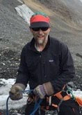
Silver reporting weather conditions to the airplanes.

So, back to camp, get ready to go, and in fact the plane came in as scheduled and picked me up, along with my gear. We flew back to Kangerlussuaq, and didn't even need to take my gear off the plane- this was the same plane that was going to fly to Summit. I got off, however, since they were going to need to fuel the plane and there would be some waiting. So I waited on the runway for a while, and finally we were ready to fly again. This flight was full with cargo, so I got to fly first-class; up on the flight deck with the pilots, flight engineer, and navigator. The scenery was spectacular as we flew over the hills towards the ice-edge, the pilot pointing out features of interest:

We were able to talk over the noise of the engines (millitary planes are much louder than civillian ones) using a headset intercom:


Once we got out past the edge of the ice sheet, the topography got less interesting, and the rest of the 2+ hour flight was passed mostly with the plane on autopilot. When we reached the location of Summit camp, however, we discovered that during the 2 hours we'd been flying a low fog bank had come in, making it dificult to see the runway, or any of the camp structures. We knew where the camp was because we had precise GPS co-ordinates, and the LC-130's forward-looking radar could 'see' the camp and the skiway markers, but when flying onto a snow runway it's important to have visibility.

This picture shows all we could see- we're at an altitude of about 250 feet- that's low!

Using the radar and maps of the skiway, the navigator skillfully put us on the approach. But even with great training and high-tech tools, we still needed to see. We flew in low, close to the skiway, and could only see the marker flags directly below us, rather than ahead of us. We didn't want to fly lower than 100 feet without a clear view, because there was a 100 foot tower in camp for sampling instruments. At the very last moment, the split-second decision had to be made- try to land or fly around for another try? Without good visibility, we had to go around. Again and again we tried- but the visibility wasn't getting any better. The pilot tried using diffferent goggles and sunglasses in an effort to see, but nothing worked. Eventually we had to face the fact that we were running low enough on fuel that we needed to turn back. So we radioed camp to give our apologies, turned around and headed back to Kangerlussuaq.

On the way back to Kangerlussuaq, we flew low over the ice edge again, with a spectacular view of the crevasse patterns that form when the ice is pulled in different directions going over steep topography:

Crevasse patterns at the ice edge. The directions of the crevasses can tell us about how the ice is moving- can you think of why?

By about 10pm, we were back in Kangerlussuaq. It'd been a long day, with many miles flown. Tomorrow morning the plan is for the summit flight to leave at 0800, so it'll be another early morning....

That's all for today- see you tomorrow!

Wednesday, May 18, 2005

Finally at Raven

Today the fog was back again in the morning, but cleared in the afternoon enough for us to fly to Raven, a skiway training facility just up on the inland ice, about a 20 minute flight in a C-130.


The LC-130 banks as we fly towards the ice sheet.

By the time we got to Raven it was about 1pm, and I set to work. I was planning to try to catch the last plane back to Kangerlussuaq in order to catch a plane to Summit the following day. I started getting my gear ready for the 5 km trip to my experiment site, where several ice cores had been drilled last year. Because I was going to be out of sight of camp I needed to carry much more than I'd otherwise need; if a storm came up I could be stuck in bad visibility, unable to come back to the main camp, so I needed camping and cooking gear and food to last several days, even though I only intended to stay out a few hours.


My gear for an afternoon out. The 2 duffels at the front of the sled carry my emergency tent, stove , food, and extra clothing. The green box carries most of my science equipment.

My site was about 5 km from the main camp, but there aren't any landmarks by which to navigate, so we use GPS:


The view of untracked snow in front of my snow machine- not much to navigate by!

This GPS shows the lattitude and longitude of my site. Can you find where I was on a map?

To keep everyone informed as to how things were going, especially since I was trying to catch a plane, I checked in each hour using an Iridium satellite phone:


My work went well. I set up my gear and started making measurements:

My setup. The white cable runs down the pipe into a borehole in the ice, where I am lowering a video camera to look at the walls of the borehole. I can see layers in the walls, much like tree rings. I use these layers to measure compaction and settling in the snow.

Although everything went well, it took long enough that I missed the plane back to Kangerlussuaq, so I got to spend a nice evening with Drew and Silver, the crew who staff this small camp. Their job is to keep the skiway in good shape for the airplanes that train here, and to provide weather observations to the planes. They live in a small 'Weatherport', an insulated tent-like structure with an oil-fired heater inside. It's a simple life and they enjoy it. They're terrific people, and were wonderful hosts.


Drew and Silver outside their home.

Tuesday, May 17, 2005

Scrubbed!

Well, our flights to the field were officially cancelled right around noon today. The irony is that the weather at our destinations was fine, it was the weather back here in Kangerlussuaq that made the pilots worried. The worry was compounded when, just before noon, an Air Greenland flight from Copenhagen was turned away due to the fog and had to land in Keflavik, Iceland (the closest airport large enough to land a full-size airliner).


The fog which caused our delay


So we no longer had to "stand by to stand by" and were free to take the afternoon off. I went along witha few others up to the hills outside of town to see if there were any Musx Oxen out and about. We did see a few, but only from a great distance.


Musk oxen, seen from a great distance...


Ed Stockard, paraglider pilot and veteran of many seasons in Antarctica and Greenland, considers the possibilities of soaring near Kangerlussuaq.


In the evening after dinner, we had a presentation by a group of architecture students who have designed a new structure to replace the various buildings at Summit.

Tomorrow morning, we'll get up and try the whole thing all over again, same schedule, different day, and hopefully different weather! here's to clear skies!

The inevitable weather-delay

Got up this morning bright and early, after nearly falling asleep at the keyboard posting last night's entry, and got myelf ready to go- organize and pack the last minute items, get into the warm clothing, and then...

the fog came in.

So, now, we're in the mode known to polar workers as "Hurry up and wait". We have to be ready to go at a moment's notice, but we could be delayed for hours.


Seth (also heading to Summit this week) waits in the fog with everyone's luggage.


Some passengers take the opportunity to catch up on sleep the was lost to last minute packing and organizing chores at home or in town.


I took the opportunity to catch up with Robin Abbott, who co-ordinates Greenland logistics for the NSF contractor, VECO Polar Resources. Robin's been working in the polar regions for years and really knows what's going on in Greenland. She lives in Kangerlussuaq about 4 months each year, throughout the summer science season. Her job involves, among other things, co-ordinating cargo and passenger movements for many field groups in Greenland. At any given time she might be talking to the air national guard about how many pounds of cargo they can carry on the next flight, or talking to a contract pilot who needs the co-ordinates of the camp he's supposed to fly to today. Because of the weather, plans change quickly and everyone needs to be flexible. Robin does a great job of staying ahead of the constantly changing schedule, always ready with alternatives.


Robin Abbott, Greenalnd logistics coordinator


With any luck, I'll get to fly out soon, so the next post will likely be when I get back from Raven- wish me luck!

Greenland 2005- first day, and a long one!

Welcome! I've started a new season. Yesterday I flew from my home in Cambridge, England, to Copenhagen, Denmark, spent the night in Copenhagen, and this morning flew from Copenhage to Kangerlussuaq, Greenland. So here I am in Greenland. This season accompanying me are Richard Hindmarsh and Ed King from the British Antarctic Survey. We arrived at about 10 am local time, thanks to a several hour time change. We got right to work, starting by organizing our cargo.


Richard (holding the box) and Ed organizing our cargo


I also had some testing to do on my equipment, which had spent the winter at Summit. I found some problems with one of the components, and after some investigation, found a chip had broken off the circuit board!

The chip that broke off the circuit board. It regulates power to the video camera.


finally, I put it all together again, and did some testing to see how well the new setup dissapates heat.

testing- note the temperature module reads in C. what is it in F?


Now all the gear is packed and ready to go, and it's time for me to get some sleep. Tomorrow morning early, I'll fly to Raven while Ed and Richard fly to Summit. With any luck I'll be posting again tomorrow evening having finished my work at Raven in 1 day! if not, I'll be back online the following day.

See you soon!

Friday, May 13, 2005

A Season for Everything

In the summer of 2004, I had another field season in Greenland. This time around, I ended up co-ordinating folks from 7 different agencies on 3 different NSF funded projects and 2 European projects. Some of the players were again familiar- I started in the field again with Gregg Lamorey, and Ryan joined us partway through. For this season, though, I had several significant objectives to cover for my own project, including drilling several shallow boreholes at 2 different locations and making 2 separate trips to the field to make measurements at different times. Also coming into the project was Simon Sheldon, a Brit working with the Danes who I knew from the North GRIP season, and Liz Morris, from the Scott Polar Research Institute.

This season we had plenty to do:

Logging sonic velocity in the ice, which tells us about the crystal orientation of the ice grains.

Unpacking the sonic logging tool. It's very long, but flexible sections make it easy to ship.

Shallow drilling:

ICDS drillers Jay Kyne and Beth Bergeron using the "Prarie Dog", a drill of Jay's own design.

Gregg Lamorey and Liz Morris making measurements on the core as it comes out of the drill.

Logging the shallow holes with my newest Borehole Optical Stratigraphy tool:

Greg, Mark Albershardt, and me (L-R) logging a shallow borehole. The sewer pipe is a shallow casing that protects the sides of the borehole as we repeatedly raise and lower instruments.

With the Danes at North GRIP

The following summer, Gregg asked me to go to Greenland again, this time to run his logging system since he was unable to go. This team would be a reunion of sorts, since it would be composed of Gary Clow, Ryan Bay, me, and Frank Urban, who'd recently taken a post with the USGS.

The deep logging team at North GRIP

Our objective this time was to carry out deep logging in the North GRIP borehole, a project of the Glaciology group at the University of Copenhagen, which was nearly complete. We had to work fast, because we needed to finish our loggging before the drillers started to drill again, to avoid the disturbance caused by the drilling. The drillers themselves had an ambitious schedule, and were keen to get rolling. So we went in on the put-in flight, and were dropped off by the C-130 to start digging out the camp, which was buried under drifts from the previous winter.

Digging out the garage, to get to the heavy equipment...


Like this giant snowblower, which makes the rest of the job easier!


Once we got set up, the logging went very smoothly, and we had a good season at North GRIP. It was a great experience and a treat to be part of an international camp.

Back to Greenland

After the Siple Dome project, I thought I was done with the field for a while, but it was not to be. In the usual manner, I got a call with a request to join a field team. This time it was Gregg Lamorey, from the Desert Research Institute at the University of Nevada in Reno. Gregg was planning a trip back to Summit, Greenland, to do more deep logging in the GISP2 and GRIP boreholes. My job for this season was mostly to run the USGS deep logging winch, and Gregg would handle the logger operations.

The USGS deep logging winch- there are 4 kilometers of cable on that spool!

Ryan Bay came on this trip as well and brought with him Nathan Bramall, who'd joined our team at Siple Dome during the 3rd season. They planned to use the dust logger and also test a new tool that they were developing called the Biospectral Logger (BSL).

It was an epic season. Some sould call it a "Shackleton season" in that we faced some seemingly insurmountable difficulties but were able, at the end of the season, to return home all in one piece and with most of the data we'd been seeking. The difficulties we faced included getting a tool stuck deep in the borehole, having the connector at the end of the cable break, and having the winch drive mechanism break several times while borehole tools were down the hole. In all cases, we were able to eventually overcome the problem, but the final breakage prevented Ryan and Nathan from getting some important data they were hoping for.

Thursday, May 12, 2005

Graduate School and Siple Dome

When I returned from the Greenland winter-over, after a sufficient time of relaxing in warm places, I asked Ed Waddington if he had any more glaciology field work for me. His response was that it'd be much easier if I were a graduate student- and so I applied to graduate school.

Graduate school entailed a lot of time in the office as well!

I entered graduate school in the fall of 1999, and immediately started work on a project at Siple Dome, Antarctica.

The main structures at Siple Dome, known as Jamesways.

This project, headed by Gary and Ed, built on the success we'd had in Greenland with our new shallow logging technique, and we installed pipes in an array of shallow boreholes across Siple Dome. We also made temperature logs in the main (1000 meter) borehole, and measured vertical motion using my video camera technique I'd developed a few years earlier.

The Siple Dome project lasted 3 years, and over the 3 field seasons we had many great successes. During the first season, I noticed that while raising my video camera I could see different shades of light and dark passing by on the borehole walls. I did some experiemnts with the camera and this led me to a new line of inquiry that has developed into Borhole Optical Stratigraphy (BOS), a technique I developed over the next several years and eventually formed the basis for my PhD dissertation, as well as several successful proposals to the National Science Foundation. I wrote a paper about the ability to detect annual layers using BOS that was published in Geophysical Research Letters. You can view the paper in HTML or PDF format.

In our second year, Gary and I enlarged our field team when we brought Rolf Tremblay, a math and science teacher from Goodman Middle school in Gig Harbor, Washington. Rolf took the photos in this post during his time in Antarctica.

Rolf standing atop Observation hill, near McMurdo Station.


Rolf helping me measure vertical motion in the upper layers of the snowpack.

Also joining our team in the second and third years was Ryan Bay, from the University of California at Berkeley. Ryan had a new boehole tool for measuring the amount of dust in the ice, and we tested it at Siple Dome.

Ryan and I lower the dust logger into the borehole- it goes straight down for a kilometer!

The Siple Dome project was a great success, and at the end of the last season I was sad to see the end of the project. But there is almost always another interesting project to pursue- it's one of the great things about glaciology, and polar science in general.

Wintering Over

The "Greenhouse" where I lived for 11 months.

After my summer in Greenland, I figured I'd start getting back to work and graduate from the University of Washington. Still, I wanted to stay in the polar game. While I'd been in Greenland, I met Jack Dibb from the University of New Hampshire. Jack was putting together a team to spend the winter at Summit, which had not been done before. The project was diplomatically called the "experimental summit winter over" by PICO, then Arctic logistics support contractor. Jack and I got along well, and I agreed to join the team as lead science technician and camp medic in the spring of 1997. I decided I had to finish college before going, which involved a flurry of exam-taking and compressing the last few weeks of the term into a few days. I then went to SOLO in New Hapmshire for Wilderness Emergency Medical Technician training before heading to Summit in late spring of 1997.
To make a long story short, I spent 2 months at Summit during the summer, preparing for the winter-over, and then was joined by 3 others for the 9-month winter season. During the winter, we had visits by 2 airplanes, Twin Otters, that brought us fresh food, mail, and smiling faces. One visit was in November, the other in February- one on each side of the period of winter darkness.
During the winter, our job was to keep all the systems of the camp running, from the diesel generators to the science equipment like this weather station wind sensor:

Another of the jobs we did every single day was to take small samples of clean surface snow. This required careful cleaning of the equipment, and the use of special 'clean suits' for sampling:

Getting ready for the winter, USA Today did an article on the winter-over, which gave me a few of those 15 minutes of fame which everyone is entitled to.
By the end of the winter, I was ready to go home- I'd spent 11 months on the ice. Apparently I continue to hold the record for the longest continuous stay at Summit.

The Early Years- First Greenland season

My Taylor Dome season had been a once-in-a-lifetime opportunity to go to Antarctica. It'd given me an interest in the polar regions and fed my desire to go back one day. I thought, though, that it'd be a while before another opportunity like that came up. Imagine my surprise, then, when Gary Clow of the United States Geological Survey sent me an email in the spring of 1996. I had worked with Gary at Taylor Dome, and he was gearing up to go to Summit, Greenland, the location of the GISP2 ice core, drilled over 3km to bedrock in the early 1990's.


A shot of Summit camp as it is today. You can see the yellow tents we sleep in. The main structure now has a satellite communications antenna which looks like a ball- in the old days we didn't have such luxuries...

Our goal was to log temperatures in the 3016-meter-deep main borehole, and to attempt a new technique to log temperatures in shallow boreholes. Because the shallow parts of an ice sheet are porous like snow, shallow boreholes will not hold fluid. For our temperature measurements, we wanted a fluid-filled hole, since air movement in the borehole can change the temperature the sensor feels, making measurement of the temperature of the ice difficult. For our new technique, we would lower a sealed pipe down the borehole, open at the surface. We would then fill the pipe with a special heat-transfer fluid. Since no borehole is absolutely vertical, the pipe would lie against the wall of the borehole, and the fluid in the pipe would come into thermal equilibrium with the ice. Air would be kept from moving in the hole by a "packer" that was installed about 10 meters deep in the hole, which we then filled in with snow, sealing it from the surface. Here's a shot of us lowering the pipe down the borehole. The black arching obhect is the pipe, made of a flexible plastic, intended initially for irrigation.

When I came back from that season, I wrote a report on the activities of the season, which I posted here in html.

Wednesday, May 11, 2005

The Early Years- First Season South


My first season in Antarctica was in 1995-96 at Taylor Dome, just up on the Antarctic polar plateau. This was the location of a 554 m ice core to bedrock, drilled in 1993-94. Participating in the field season under the NSF's Research Experience for Undergraduates program, I was a member of a 4 person team led by Ed Waddington of the University of Washington's Department of Earth and Space Sciences. We spent 6 weeks at Taylor Dome, making glaciological measurements, from surveying stakes using GPS to measure ice motion, to measuring accumulation and ablation on the ice sheet, measuring temperatures in the borehole left over from the coring operations, and looking into the borehole with the video camera you see below.

This is the downhole camera we lowered into the borehole. The camera looks straight down the borehole- the view is like this:

In the field of view you can see the prism that hangs at the bottom of the camera, and there is a dark circle, which is a metal marking band that has been inserted into the hole. We used the camera to measure the motion of these marking bands, and from these measurements, we calculated the age of the ice deep in the hole. I wrote a paper about this technique in the Journal of Glaciology. You can view the final paper in either HTML or PDF format.

This was a life-changing experience for me, and opened my eyes to the possibility of a career in polar science, and to working in the Antarctic and Artcic. When I came home, I decided to become a glaciologist, and I've stayed in glaciology ever since.