Today was another survey day, this time visiting 10 poles placed between 3 km and 18 km from Summit, and measuring the locations with geodetic-quality GPS. It was a long day, but it means we're almost done with this (GPS survey) task.
The view you would have if you were my backseat passenger while we drive
across the completely blank white canvas of the ice sheet. Though it's
all snow, there's an enormous variety of visual textures, so it doesn't
really get boring.
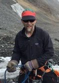
When we get to one of our poles (I almost tried to take a picture of what it looks like in the distance from about 500 meters away, but it would have been invisible!), we make sure it's still plumb using a rod level (this way we don't get some spurious movement simply from a tilting pole).
Then we mount our GPS antenna on the pole. Depending on how far away from our base station (at summit) we are, we need to wait between 20 and 45 minutes in order to collect enough data to get a position with enough accuracy for our needs.
What do we do while waiting? Here, Joanna demonstrates the alternative decoding of the acronym "GPS": Great Places to Sleep!
With luck, the weather plays along tomorrow and we have our last day of surveying.


0 Comments:
Post a Comment
<< Home