More GPS surveying

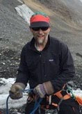
Today the winds were pretty high, so it would have been difficult to dig a pit (it would fill in almost as fast as you could dig it out). I spent much of the day working with the science techs, going over the protocol for the GPS surveying they do each month (I posted about this surveying a while ago here). Before we went out, I placed a standalone GPS station (above) to record a very accurate measure of one spot along the transect. This way we can test out other GPS receiver on the sled- processed kinematically- to see how close it gets to the "real" answer for he surface elevation. Despite the high winds, the whole thing went off beautifully, and I came back with many modifications to make to the sampling protocol, a document that outlines exactly the procedures to take for this experiment.
posted by Bob @ 23:59
0 comments
![]()

0 Comments:
Post a Comment
<< Home